High Peak 2006
High Peak and Tissington Trails

For anybody who likes taking their bike on the railway, Derbyshire County Council have found the perfect solution. They have converted their railways into cycle tracks – the next best thing to driving your own train.
You may think that is an exaggeration, but riding along a level, smooth surfaced path on a sunny autumn day in some of the best scenery in the land could be even better than travelling by train.
Overnighting at Hartington Youth Hostel in September, we planned riding the High Peak Trail to its end near Cromford – handy for Matlock Youth Hostel. After having struggled up the hills from Derby to Hartington it looked like being an easy day. And so it was, apart from the first couple of miles to the starting point at Hartington Station. I would have walked it if I hadn’t had to keep up with Ron. Andrew walked most of it.
Not having a map of the trail, I was obliged to memorise the route from the map displayed at Hartington Station. This was not difficult, as there is only one track, going from the junction just up the road all the way to the End of Trail at Cromford. We do not make a great point of riding together, so I let the other two go while I finished my Mars Bar, promising to catch up with them later. I never did as I found the trail itself far too interesting to hurry over.
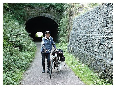
Hartington Station is actually on the Tissington Trail, and the High Peak Trail starts at the junction a mile further on. This is no mountain bike trail, but a smoothly surfaced, even path any road bike can tackle. The traffic is very light, consisting of cyclists, walkers and maybe a few horse riders, and the scenery is great. This being one of the oldest railways, built on canal principles, there are few cuttings, and the trail winds its way round the contours, through farmers’ back yards almost all the way to Middleton Top, twelve miles further on. A lovely ride bordered by trees and flowers, there are several car parks and access points along the way, so the risk of getting too far away from civilisation is slight.
At Middleton Top there is a teashop and information centre. You then go through a short tunnel before reaching the edge of the escarpment, where there is an engine house for hauling the wagons up and down the steep incline. I was told that this was originally a horse railway, though how it operated is something of a mystery, considering the steep descent from Middleton Top to the end at Cromford. Cyclists are advised to walk, and I was glad to do so, as it must have been 20% in places.
The End of Trail is beautifully placed by the canal and river, where you can take your ease and buy some refreshments and wander around the old workshops and find all the information you need to satisfy your curiosity.
If you are going to Matlock, as I was, there is no need to take the main road and fight all that traffic. Just ride over the canal and river bridges and you meet the minor road to Matlock, about six miles away. I got there soon after five o’clock, just in time to but a few groceries at the Co-op before walking up the hill to the hostel.
Derbyshire County Council offer further information about the High Peak and Tissington Trails on their website at www.derbyshire.gov.uk